by Louise Colville
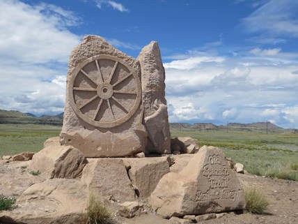
The Old Spanish Trail is known to have been the longest, crookedest, most arduous pack mule route in the history of America. It was approximately 2,700 miles of high mountains, deserts, deep canyons and changing climate. It ran through what is now New Mexico, Colorado, Arizona, Utah, Nevada and California. Some caravans lost their way and all of the suffered, men and animals.
The Native peoples who lived in present New Mexico, Colorado and Utah were the first to use a system of trails in the region for hunting, trading and travel. It could have just as easily been called the Old Ute Trail.
Juan Antonio Maria de Rivera in 1765 with his group of unarmed men traveled north from Abiquiu to the “Piedra Parada” (Standing Rock) that is now known as Chimney Rock in the Pagosa Springs, Colorado area. Then they traveled west along the south edge of the San Juan Mountains to present Animas River where they headed west to a big bend in the Dolores River at an “important” trail junction. The route eventually became part of the Old Spanish Trail.
Father Francisco Atanasio Dominguez and Father Silvestre Velez de Escalante traveled as an expedition to establish an overland route between Santa Fe and the Catholic Mission at Monterey, California. Their route took them through some the country that would also be part of the Old Spanish Trail. They were unable to make it to California because of the lateness of the season and returned to Santa Fe by a southern route.
These expeditions did create amicable relationships with the Native people that they encountered.
The middle part of the trail through Nevada and California was worked out by trappers led by Jedediah Smith about 1827.
Santa Fe area had been a long-time hub of trading starting back in the 1700s with the trading fairs and then the trappers.
With the Mexican Independence from Spain in 1821, trade between the eastern United States and Mexico was flourishing. The Santa Fe Trail was established in 1822 bringing United States merchandise into the Santa Fe and Taos areas and then down into Mexico by the El Camino de Tierra Adentro, a popular wagon, immigration and trade route that the Spanish had used since 1598 and probably longer than that. The trading hub was Santa Fe for both the Santa Fe and the Old Spanish Trail.
The Old Spanish Trail was officially traveled in 1829 when Antonio Armijo, a Santa Fe merchant, combined information from previous explorers and led a trade party of sixty men and one hundred mules to California. Santa Fe was no longer “land locked” for trading and selling goods. California had their sea ports to be able to trade. Now, the North American markets were extended across the Pacific to Asia. This was in the plans when the exploration on the Santa Fe Trail has started.
The Old Spanish Trail’s primary use was to have a trade route between Los Angeles and Santa Fe. Sheep and high quality woven goods such as the Rio Grande blankets were traded for horses and mules raised by the California ranchers. These animals brought high prices in New Mexico and on the western frontier of the United States.
Armijo avoided the worst part of the Mojave Desert by traveling south of Death Valley. He followed intermittent streams and located new springs to support the party. He did successfully get his expedition to San Gabriel Mission at Los Angeles with his group intact, but they did have to survive on mule meat during the last days of the trip.
After trading blankets and other goods, they returned to Santa Fe. Armijo was rewarded by the recognition of being the “Commander for the Discovery of the Route to California.”
With the successful trip, more expeditions with regular trips were done. Some emigrate travel occurred as well. Not everything was legal along the trail with criminal activities including raiding California ranchos for horses and for an extensive Native slave trade with trading at both ends of the trail even though this practice was officially discouraged.
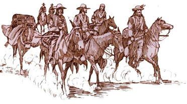
Caravans usually left Santa Fe in the fall so the deserts could be crossed when temperatures were lower and return in the spring for the new grass to fed the large herds of animals be driven back to New Mexico. Mules were loaded with goods and they had to climb up narrow paths, swing across streams and rivers and at times drag their muleteers across roaring, flooding rivers.
Over the years with more use, several main routes and alternate routes were developed. One route was following the Colorado River to Needles, California. This route became the preferred route. If trading with the Utes was the purpose of the trip, then the route further to the north to Salt Lake was the chosen route.
The main route began at Santa Fe, looped northward through Colorado and Utah to avoid the deep river gorges of the Grand and Glen Canyons on the Colorado River before dropping down to the area that now has present Las Vegas, Nevada. From here it crossed the Mojave desert before reaching the San Gabriel Mission.
In 1830-31, William Wolfskill and George Yount developed another route, but used some of the same landmarks. Their route followed the Colorado River to Needles, California and up the Mojave River to Cajon Pass.
In research work written by Angie Krall, archeologist for Rio Grande National Forest, she explains that the “North Branch” of the Old Spanish Trail is identified as a variant to the “Northern Route” that was blazed by George C. Yount and William Wolfskill in 1831. The North branch ran through the San Luis Valley and the Gunnison River Valley of Colorado into eastern Utah, and then crossing Nevada and California. The North branch was largely open during the winter when other passes were snowed in. It then went up the Gunnison River Valley, rejoining the Northern route near present Green River, Utah. The North Branch is the one that is focused on primarily as it relates to the history and development of the settling of the San Luis Valley and the Plaza areas in and around the present Del Norte and Monte Vista.
The Americans became aware to the trail after John C. Fremont published his report of the 1844 expedition from California to the United States which was the final leg of the expedition to Oregon for the United States Topographical Corps. His report helped to trigger more Manifest Destiny excitement in the United States. Fremont had taken the trail across Utah. In his report, he called it the “Spanish Trail”. Some says that Kit Carson gave the trail the name.
After the Mexican-American War, the use of the trail for trade diminished. There were less dangerous and shorter routes that became available. Because there were better emigration routes to the north and the south, it was not other used for the purpose.